
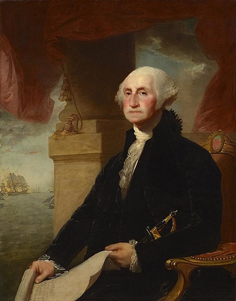
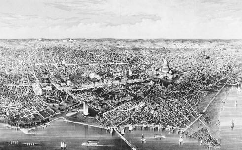
The history of Washington, D.C. is tied to its role as the capital of the United States. Originally inhabited by an Algonquian-speaking people known as the Nacotchtank, the site of the District of Columbia along the Potomac River was first selected by President George Washington. The city came under attack during the War of 1812 in an episode known as the Burning of Washington. Upon the government's return to the capital, it had to manage reconstruction of numerous public buildings, including the White House and United States Capitol. The McMillan Plan of 1901 helped restore and beautify the downtown core area, including establishing the National Mall, along with numerous monuments and museums.

Unique among cities with a high percentage of African Americans, Washington has had a significant black population since the city's creation. As a result, Washington became both a center of African American culture and a center of civil rights movement. Since the city government was run by the federal government, black and white school teachers were paid at an equal scale as workers for the federal government. It was not until the administration of President Woodrow Wilson, a southern Democrat who had numerous southerners in his cabinet, that federal offices and workplaces were segregated, starting in 1913.[1] This situation persisted for decades: the city was racially segregated in certain facilities until the 1950s.

Today, DC is marked by contrasts. Neighborhoods on the eastern periphery of the central city, and east of the Anacostia River tend to be disproportionately lower-income. Following World War II, many middle-income whites moved out of the city's central and eastern sections to newer, affordable suburban housing, with commuting eased by highway construction. The assassination of Martin Luther King, Jr. in 1968 sparked major riots in chiefly African American neighborhoods east of Rock Creek Park. Large sections of the central city remained blighted for decades. By contrast, areas west of the Park, including virtually the entire portion of the District between the Georgetown and Chevy Chase neighborhoods (the latter of which spills into neighboring Chevy Chase, Maryland), contain some of the nation's most affluent and notable neighborhoods. During the early 20th century, the U Street Corridor served as an important center for African American culture in DC.
The Washington Metro opened in 1976. A rising economy and gentrification in the late 1990s and early 2000s led to revitalization of many downtown neighborhoods.

Article One, Section 8, of the United States Constitution places the District (which is not a state) under the exclusive legislation of Congress. Throughout its history, Washington, D.C. residents have therefore lacked voting representation in Congress. The Twenty-third Amendment to the United States Constitution, ratified in 1961, gave the District representation in the Electoral College. The 1973 District of Columbia Home Rule Act provided the local government more control of affairs, including direct election of the city council and mayor.

Early settlement
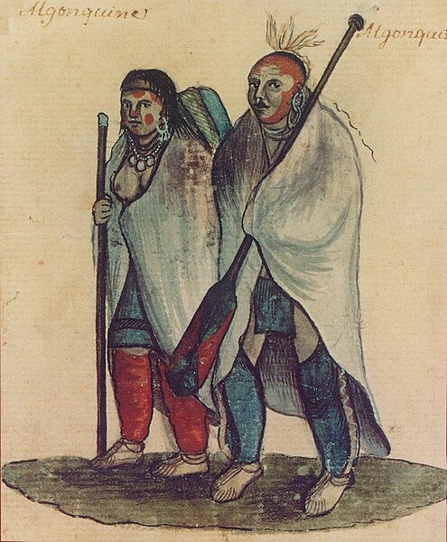
Archaeological evidence indicates Native Americans settled in the area at least 4000 years ago, around the Anacostia River.[2] Early European exploration of the region took place early in the 17th century, including explorations by Captain John Smith in 1608.[3][4]

At the time, the Patawomeck (loosely affiliated with the Powhatan) and the Doeg lived on the Virginia side, as well as on Theodore Roosevelt Island, while the Piscataway (also known as Conoy) tribe of Algonquians resided on the Maryland side.[5] Native inhabitants within the present-day District of Columbia included the Nacotchtank, at Anacostia, who were affiliated with the Conoy.[6] Another village was located between Little Falls and Georgetown,[5] and English fur trader Henry Fleet documented a Nacotchtank village called Tohoga on the site of present-day Georgetown.[7]

The first colonial landowners in the present-day District of Columbia were George Thompson and Thomas Gerrard, who were granted the Blue Plains tract in 1662, along with Saint Elizabeth, and other tracts in Anacostia, Capitol Hill, and other areas down to the Potomac River in the following years. Thompson sold his Capitol Hill properties in 1670, including Duddington Manor, to Thomas Notley; The Duddington property was handed down over the generations to Daniel Carroll, of Duddington.[8] As European settlers arrived, they clashed with the Native Americans over grazing rights. In 1697, Maryland authorities built a fort within what is now the District of Columbia. In that same year, the Conoy relocated to the west, near what is now The Plains, Virginia, and in 1699 they moved again, to Conoy Island near Point of Rocks, Maryland.[9][10]
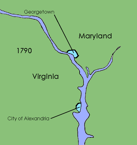
Georgetown was established in 1751 when the Maryland legislature purchased sixty acres of land for the town from George Gordon and George Beall at the price of £280,[11] while Alexandria, Virginia was founded in 1749.

Situated on the fall line, Georgetown was the farthest point upstream to which oceangoing boats could navigate the Potomac River. Gordon had constructed a tobacco inspection house along the Potomac in approximately 1745. Warehouses, wharves, and other buildings were added, and the settlement rapidly grew. The Old Stone House, located in Georgetown, was built in 1765 and is the oldest standing building in the District. It did not take long before Georgetown grew into a thriving port, facilitating trade and shipments of tobacco and other goods from colonial Maryland.[12]

Founding

The United States capital was originally located in Philadelphia, beginning with the First and Second Continental Congress, followed by the Congress of the Confederation upon gaining independence. In June 1783, a mob of angry soldiers converged upon Independence Hall to demand payment for their service during the American Revolutionary War. Congress requested that John Dickinson, the governor of Pennsylvania, call up the militia to defend Congress from attacks by the protesters. In what became known as the Pennsylvania Mutiny of 1783, Dickinson sympathized with the protesters and refused to remove them from Philadelphia. As a result, Congress was forced to flee to Princeton, New Jersey on June 21, 1783.[13]
Dickinson's failure to protect the institutions of the national government was discussed at the Philadelphia Convention in 1787[citation needed]. The delegates therefore agreed in Article One, Section 8, of the United States Constitution to give the Congress the power:
To exercise exclusive Legislation in all Cases whatsoever, over such District (not exceeding ten Miles square) as may, by Cession of Particular States, and the Acceptance of Congress, become the Seat of the Government of the United States, and to exercise like Authority over all Places purchased by the Consent of the Legislature of the State in which the Same shall be, for the Erection of Forts, Magazines, Arsenals, dock-Yards and other needful Buildings;[14]
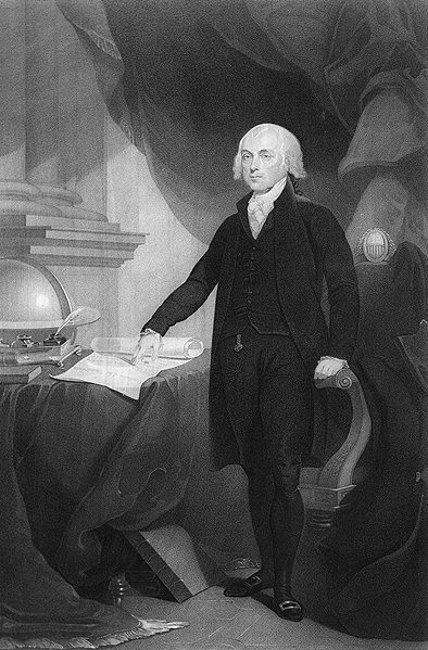
James Madison, writing in Federalist No. 43, also argued that the national capital needed to be distinct from the states, in order to provide for its own maintenance and safety.[15] The Constitution, however, does not select a specific site for the location of the new District. Proposals from the legislatures of Maryland, New Jersey, New York, and Virginia all offered territory for the location of the national capital. Northern states preferred a capital located in one of the nation's prominent cities, unsurprisingly, almost all of which were in the north. Conversely, Southern states preferred that the capital be located closer to their agricultural and slave-holding interests.[16]

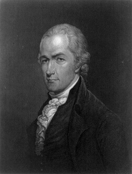
The selection of the area around the Potomac River, which was the boundary between Maryland and Virginia, both slave states, was agreed upon between James Madison, Thomas Jefferson, and Alexander Hamilton. Hamilton had a proposal for the new federal government to take over debts accrued by the states during the Revolutionary War. However, by 1790, Southern states had largely repaid their overseas debts. Hamilton's proposal would require Southern states to assume a share of Northern debt. Jefferson and Madison agreed to this proposal and in return secured a Southern location for the federal capital.[17]
On December 23, 1788, the Maryland General Assembly passed an act, allowing it to cede land for the federal district. The Virginia General Assembly followed suit on December 3, 1789.[18] The signing of the federal Residence Act on July 6, 1790, mandated that the site for the permanent seat of government, "not exceeding ten miles square" (100 square miles), be located on the "river Potomack, at some place between the mouths of the Eastern-Branch and Connogochegue".[19][20] The "Eastern-Branch" is known today as the Anacostia River. The Connogocheque (Conococheague Creek) empties into the Potomac River upstream near Williamsport and Hagerstown, Maryland. The Residence Act limited to the Maryland side of the Potomac River the location of land that commissioners appointed by the President could acquire for federal use.[19]

The Residence Act authorized the President to select the actual location of the site.[19] However, President George Washington wished to include the town of Alexandria, Virginia within the federal district. To accomplish this, the boundaries of the federal district would need to encompass an area on the Potomac that was downstream of the mouth of the Eastern Branch.

The U.S. Congress amended the Residence Act in 1791 to permit Alexandria's inclusion in the federal district. However, some members of Congress had recognized that Washington and his family owned property in and near Alexandria, which was just seven miles (11 km) upstream from Mount Vernon, Washington's home and plantation. The amendment therefore contained a provision that prohibited the "erection of the public buildings otherwise than on the Maryland side of the river Potomac".[21][22]

The final site was just below the fall line on the Potomac, the furthest inland point navigable by boats. It included the ports of Georgetown and Alexandria. The process of establishing the federal district, however, faced other challenges in the form of strong objections from landowners such as David Burns who owned a large, 650-acre (260 ha) tract of land in the heart of the district.[21] On March 30, 1791, Burns and eighteen other key landowners relented and signed an agreement with Washington, where they would be compensated for any land taken for public use, half of remaining land would be distributed among the proprietors, and the other half to the public.[21]

Pursuant to the Residence Act, President Washington appointed three commissioners (Thomas Johnson, Daniel Carroll, and David Stuart) in 1791 to supervise the planning, design and acquisition of property in the federal district and capital city.[18] In September 1791, the three commissioners agreed to name the federal district as "The Territory of Columbia," and the federal city as the "City of Washington."[23][24]
Working under the general supervision of the three commissioners and at the direction of President Washington, Major Andrew Ellicott, assisted by his brothers Benjamin and Joseph Ellicott, Isaac Briggs, George Fenwick, and an African American, Benjamin Banneker, surveyed the borders of the Territory of Columbia with Virginia and Maryland during 1791 and 1792.[25] The survey began at Jones Point, a cape located at the confluence of Hunting Creek and the Potomac River south of Alexandria.


The survey team enclosed within a square an area containing the full 100 square miles (260 km2) that the Residence Act had authorized. Each side of the square was 10 miles (16 km) long. The axes between the corners of the square ran north–south and east–west.[26] The center of the square is within the grounds of the Organization of American States headquarters west of the Ellipse.[27]

The survey team placed sandstone boundary markers at or near every mile point along the sides of the square. Many of these markers still remain. The south cornerstone is at Jones Point.[28] The west cornerstone is at the west corner of Arlington County, Virginia.[29] The north cornerstone is south of East-West Highway near Silver Spring, Maryland, west of 16th Street.[30] The east cornerstone is east of the intersection of Southern Avenue and Eastern Avenue.[31]
Plan of the City of Washington

In early 1791, President Washington appointed Pierre (Peter) Charles L'Enfant to devise a plan for the new city in an area of land at the center of the federal territory that lay between the northeast shore of the Potomac River and the northwest shore of the Potomac's Eastern Branch.[32] L'Enfant then designed in his "Plan of the city intended for the permanent seat of the government of the United States..." the city's first layout, a grid centered on the United States Capitol, which would stand at the top of a hill (Jenkins Hill) on a longitude designated as 0:0. The grid filled an area bounded by the Potomac River, the Eastern Branch (now named the Anacostia River), the base of an escarpment at the Atlantic Seaboard Fall Line along which a street (initially Boundary Street, now Florida Avenue) would later travel, and Rock Creek.[33][34][35][36][37][38][39][40]
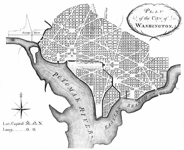
North-south and east-west streets formed the grid. Wider diagonal "grand avenues" later named after the states of the union crossed the grid. Where these "grand avenues" crossed each other, L'Enfant placed open spaces in circles and plazas that were later named after notable Americans.

L'Enfant's broadest "grand avenue" was a 400 feet (122 m)-wide garden-lined esplanade, which he expected to travel for about 1 mile (1.6 km) along an east-west axis in the center of an area that the National Mall now occupies.[38] A narrower avenue (Pennsylvania Avenue) connected the "Congress house" (the Capitol) with the "President's house" (the White House).[38] In time, Pennsylvania Avenue developed into the capital city's present "grand avenue".

L'Enfant's plan included a system of canals, one of which would travel near the western side of the Capitol at the base of Jenkins Hill.[38] To be filled in part by the waters of Tiber Creek, the canal system would traverse the center of the city and would enter both the Potomac River and the Eastern Branch.

On August 19, 1791, L'Enfant presented his plan to President Washington.[33][41] However, L'Enfant subsequently entered into a number of conflicts with the three commissioners and others involved in the enterprise.

During a particularly contentious period in February 1792, Andrew Ellicott informed the commissioners that L'Enfant had not arranged to have the city plan engraved and had refused to provide him with an original plan that L'Enfant was then holding. Ellicott, with the aid of his brother, Benjamin Ellicott, then revised the plan, despite L'Enfant's protests.[42][43][44][45][46][47] Ellicott's revisions realigned and straightened Massachusetts Avenue, eliminated five short radial avenues and added two others, removed several plazas and straightened the borders of the future Judiciary Square.[48][49]

Shortly thereafter, Washington dismissed L'Enfant. Ellicott gave the first version of his own plan to James Thakara and John Vallance of Philadelphia, who engraved, printed and published it. This version, printed in March 1792, was the first Washington city plan that received wide circulation.[50]
![[dc+1801+George+Town+and+Federal+City,+or+City+of+Washington.+Color+aquatint+by+T.+Cartwright+of+London+after+George+Beck+of+Philadelphia.+Published+by+Atkins+&+Nightingale+of+London+and+Philadelphia..jpg]](https://blogger.googleusercontent.com/img/b/R29vZ2xl/AVvXsEg6ONVSLUf6H6kEFN8Di46rNSpu_EySr6lzqC0OkG3weW3OgWBFkOSHt6j73_g-3UuZWfWK1Q1l8S6kCHzHis5bYG0NM6lIFvqeBsZI5h1oYbNSL339J3DAhZ8qnuY6KPc6Tehu2OhHjzk/s400/dc+1801+George+Town+and+Federal+City,%2Bor%2BCity%2Bof%2BWashington.%2BColor%2Baquatint%2Bby%2BT.%2BCartwright%2Bof%2BLondon%2Bafter%2BGeorge%2BBeck%2Bof%2BPhiladelphia.%2BPublished%2Bby%2BAtkins%2B%26%2BNightingale%2Bof%2BLondon%2Band%2BPhiladelphia..jpg)
After L'Enfant departed, Ellicott continued the city survey in accordance with his revised plan, several larger and more detailed versions of which were also engraved, published and distributed. As a result, Ellicott's revisions became the basis for the capital city's future development.

In 1800, the seat of government was finally moved to the new city, and on February 27, 1801, the District of Columbia Organic Act of 1801 placed the District under the jurisdiction of Congress. The act also organized the unincorporated territory within the District into two counties: the County of Washington on the northeast bank of the Potomac, and the County of Alexandria on the southwest bank. On May 3, 1802, the City of Washington was granted a municipal government consisting of a mayor appointed by the President of the United States.

19th century
Economic development
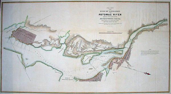
The District of Columbia relied on Congress for support for capital improvements and economic development initiatives.[51] However, Congress lacked loyalty to the city's residents and was reluctant to provide support.[51] Congress did provide funding for the Washington City Canal in 1809, after earlier private financing efforts were unsuccessful. Construction began in 1810 and the canal opened in late 1815, connecting the Anacostia River with Tiber Creek.[52]
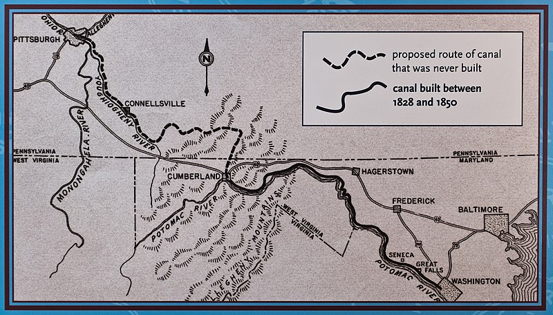
Construction of the Chesapeake and Ohio Canal (C&O) began in Georgetown in 1828. Construction westward through Maryland proceeded slowly. The first section, from Georgetown to Seneca, Maryland, opened in 1831.[53] In 1833 an extension was built from Georgetown eastward, connecting to the City Canal. The C&O reached Cumberland, Maryland in 1850, although by that time it was obsolete as the Baltimore and Ohio Railroad (B&O) had arrived in Cumberland in 1842.[54]:1 The canal had financial problems, and plans for further construction to reach the Ohio River were abandoned.[55]:7
War of 1812

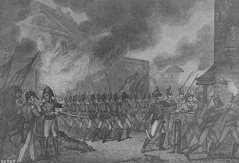
During the War of 1812, British forces conducted an expedition between August 19 and 29, 1814, that took and burned the capital city. On August 24, the British routed an American militia, which had gathered at Bladensburg, Maryland to protect the capital (see Battle of Bladensburg). The militia then abandoned Washington without a fight. President James Madison and the remainder of the U.S. government fled the capital shortly before the British arrived.

![[DC+1800+A+View+of+the+Capitol+of+Washington+Watercolor+by+William+Birch,+ca.+1800..jpg]](https://blogger.googleusercontent.com/img/b/R29vZ2xl/AVvXsEjca7gR9Wkeo7N4ys6ErZr5xsul1rL0HfrllasjLEvpOaLd4mCD9Kz4wzdbOzp7PEAbK9_vwQ-KnJhjD5epiyhQuS0HO3ixzVTpLKF4urDnew7jS_zA2osozabHFOzqdl1cKvNWfjM9Ox0/s400/DC+1800+A+View+of+the+Capitol+of+Washington+Watercolor+by+William+Birch,%2Bca.%2B1800..jpg)
The British then entered and burned the capital during the most notably destructive raid of the war. British troops set fire to the capital's most important public buildings, including the Presidential Mansion (the White House), the United States Capitol, the Arsenal, the Navy Yard, the Treasury Building, and the War Office, as well as the north end of the Long Bridge, which crossed the Potomac River into Virginia. The British, however, spared the Patent Office and the Marine Barracks. Dolley Madison, the first lady, or perhaps members of the house staff, rescued the Lansdowne Portrait, a full-length painting of George Washington by Gilbert Stuart as the British approached the Mansion.[56]

Railroads arrive in Washington
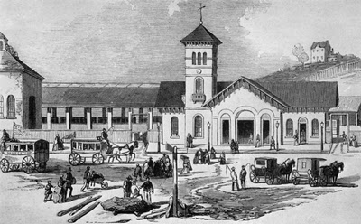
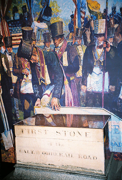
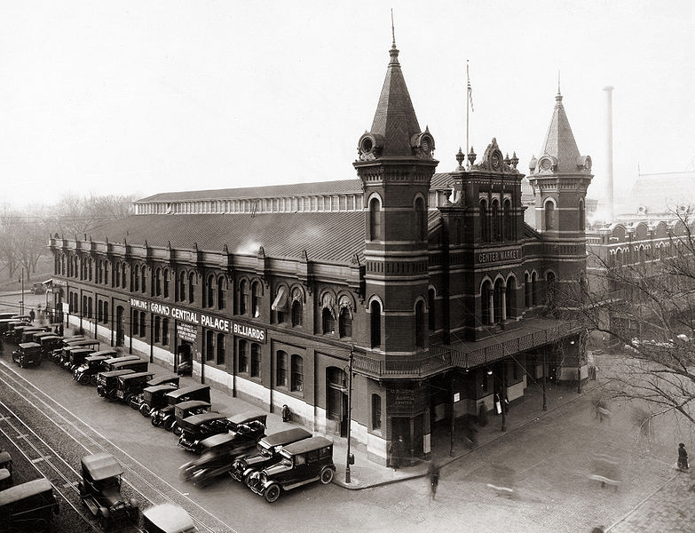
The B&O opened a rail line from Baltimore to Washington in 1835.[57]:157 Passenger traffic on the Washington Branch had increased by the 1850s, as the company opened a large station in 1851 on New Jersey Avenue NW, just north of the Capitol.[58]:92 Further railroad development continued after the Civil War, with a new B&O line (the Metropolitan Branch) connecting Washington to the west, and the introduction of competition from the Baltimore and Potomac Railroad in the 1870s. In 1907, Union Station opened as the city's central terminal.[58]:227
Retrocession

- Alexandria's economy had stagnated as competition with the port of Georgetown, D.C. had begun to favor the north side of the Potomac, where most members of Congress and local federal officials resided.
- The Residence Act prohibited federal offices from locating in Virginia.
- Alexandria was a center for slave trading. There was increasing talk of abolition of slavery in the national capital. Alexandria's economy would suffer if slavery were outlawed in the District of Columbia.
- There was an active abolition movement in Virginia, and the pro-slavery forces held a slim majority in the Virginia General Assembly. (Eighteen years later, in the Civil War, the most anti-slavery counties would secede from Virginia to form West Virginia.) If Alexandria and Alexandria County were retroceded to Virginia, they would provide two new pro-slavery representatives.
- The Alexandria Canal, which connected the C&O Canal to Alexandria, needed repairs, which the federal government was reluctant to fund.
- Alexandria's residents had lost representation and the right to vote at any level of government.
After a referendum, Alexandria County's citizens petitioned Congress and Virginia to return the area to Virginia. By an act of Congress on July 9, 1846, and with the approval of the Virginia General Assembly, the area south of the Potomac (39 square miles; 101 km²) was returned, or "retroceded," to Virginia effective in 1847.[59]
The retroceded land was then known as Alexandria County, Virginia, and now includes a portion of the independent city of Alexandria and all of Arlington County, the successor to Alexandria County. A large portion of the retroceded land near the river was an estate of George Washington Parke Custis, who had supported the retrocession and helped develop the charter in the Virginia General Assembly for the County of Alexandria, Virginia. The estate (Arlington Plantation) would be passed on to his daughter (the wife of Robert E. Lee), and would eventually become Arlington National Cemetery.


Civil War era

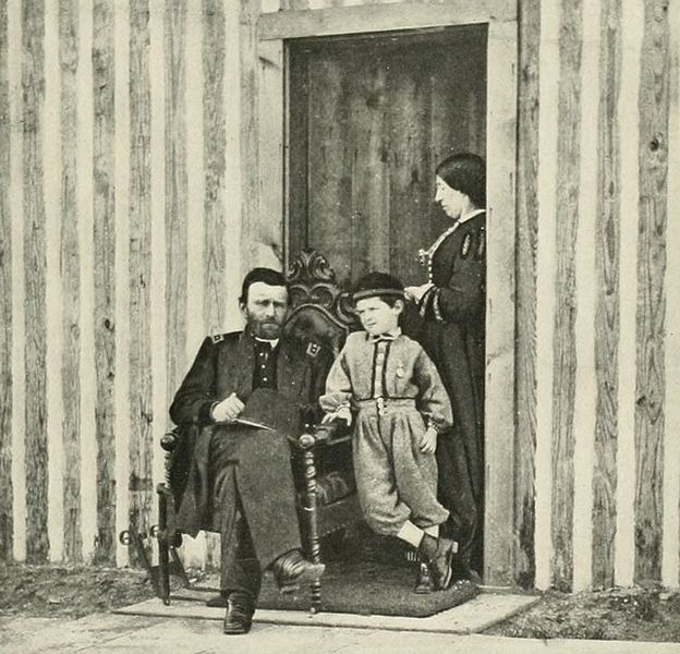
Washington remained a small city of a few thousand residents, virtually deserted during the torrid summertime, until the outbreak of the Civil War in 1861. President Abraham Lincoln created the Army of the Potomac to defend the federal capital, and thousands of soldiers came to the area. The significant expansion of the federal government to administer the war—and its legacies, such as veterans' pensions—led to notable growth in the city's population – from 75,000 in 1860 to 132,000 in 1870.

Slavery was abolished throughout the District on April 16, 1862 – eight months before Lincoln issued the Emancipation Proclamation — with the passage of the Compensated Emancipation Act.[61] The city became a popular place for freed slaves to congregate.


On April 14, 1865, just days after the end of the war, Lincoln was shot in Ford's Theatre by John Wilkes Booth during the play Our American Cousin. The next morning, at 7:22 am, President Lincoln died in the house across the street, the first American president to be assassinated. Secretary of War Edwin M. Stanton said, "Now he belongs to the ages."


Post-Civil War era
By 1870, the District's population had grown 75% from the previous census to nearly 132,000 residents.[63] Despite the city's growth, Washington still had dirt roads and lacked basic sanitation. The situation was so bad that some members of Congress suggested moving the capital further west, but President Ulysses S. Grant refused to consider such a proposal.[64]
In response to the poor conditions in the capital, Congress passed the Organic Act of 1871, which revoked the individual charters of the cities of Washington and Georgetown, and a created a new territorial government for the whole District of Columbia.[65] The act provided for a governor appointed by the President, a legislative assembly with an upper-house composed of eleven appointed council members and a 22-member house of delegates elected by residents of the District, as well as an appointed Board of Public Works charged with modernizing the city.[66]

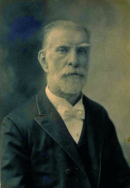
President Grant appointed Alexander Robey Shepherd, an influential member of the Board of Public Works, to the post of governor in 1873. Shepherd authorized large-scale municipal projects, which greatly modernized Washington. However, the governor spent three times the money that had been budgeted for capital improvements and ultimately bankrupted the city.[67] In 1874, Congress abolished the District's territorial government and replaced it with a three-member Board of Commissioners appointed by the President, of which one was a representative from the United States Army Corps of Engineers. The three Commissioners would then elect one of themselves to be president of the commission.[68]
An additional act of Congress in 1878 made the three-member Board of Commissioners the permanent government of the District of Columbia. The act also had the effect of eliminating any remaining local institutions such as the boards on schools, health, and police.[69] The Commissioners would maintain this form of direct rule for nearly a century.[70]


The first motorized streetcars in the District began service in 1888 and spurred growth in areas beyond the City of Washington's original boundaries.[71] In 1888, Congress required that all new developments within the District conform to the layout of the City of Washington.[72] The City of Washington's northern border of Boundary Street was renamed Florida Avenue in 1890, reflecting growth of suburban areas in the County of Washington.[71] The city's streets were extended throughout the District starting in 1893.[72] An additional law passed in 1895 mandated that Washington formally absorb Georgetown, which until then had maintained a nominal separate identity, and renamed its streets.[73] With a consolidated government and the transformation of suburban areas within the District into urban neighborhoods, the entire city eventually took on the name Washington, D.C.[71]

In the early 1880s, the Washington City Canal was covered over. Originally an expansion of Tiber Creek, the canal connected the Capitol with the Potomac, running along the north side of the Mall where Constitution Avenue is today. However, as the nation transitioned over to railroads for its transport, the canal had become nothing more than a stagnant sewer, and so it was removed.[52]

Some reminders of the canal still exist. South of the Capitol, a road named Canal Street connects Independence Avenue, SW, and E Street, SE (although the northernmost section of the street was renamed Washington Avenue to commemorate the state of Washington).[74] A lock keeper's house built in 1835 at the eastern terminal of the C&O Canal (where the C&O emptied into Tiber Creek and the Potomac River) remains at the southwest corner of Constitution Avenue, NW, (formerly B Street, NW) and 17th Street, NW.[75][76] The western end of the City Canal emptied into the Potomac and connected with the C&O Canal near the lock keeper's house.[77][78][79]
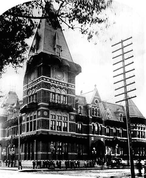
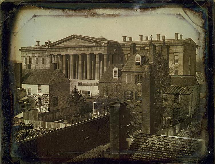
One of the most important Washington architects of this period was the German immigrant Adolf Cluss.[80] From the 1860s to the 1890s, he constructed over 80 public and private buildings throughout the city, including the National Museum, the Agriculture Department, Sumner and Franklin schools.
The Washington Monument, a tribute to George Washington and the world's tallest stone structure, was completed in 1884.[81]

20th century

In 1901, the Senate Park Improvement Commission of the District of Columbia (the "McMillan Commission"), which Congress had formed the previous year, formulated the McMillan Plan, an architectural plan for the redevelopment of the National Mall.[82]
The commission was inspired by L'Enfant's 1791 plan for the city, which had not been fully realized. The members of the commission also sought to emulate the grandeur of European capitals such as Paris, London, and Rome. They were also strongly influenced by the City Beautiful movement, a Progressive ideology that intended to build civic virtue in the poor through important, monumental architecture. Several of the Commission members, including Daniel Burnham and Frederick Law Olmsted, Jr. had in fact participated in the 1893 World Columbian Exposition, which was widely popular and helped to spread interest in the City Beautiful movement.

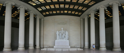
The McMillan Plan in many respects was an early form of urban renewal that removed many of the slums that surrounded the Capitol, replacing them with new public monuments and government buildings. The Plan proposed a redesign of the National Mall and the construction of the future Burnham-designed Union Station. World War I interrupted the execution of the Plan, but construction of the Lincoln Memorial in 1922 largely completed it.

Although the McMillan Plan resulted in the demolition of some slums in the Federal Triangle area, substandard housing was a much larger problem in the city during the early 1900s, with large portions of the population living in so-called "alley dwellings."[83] Progressive efforts eventually led to the creation of the Alley Dwelling Authority in 1934. The agency, led by John Ihlder, was an early example of a public housing agency, and was responsible for demolishing slum housing and building new units that were affordable, modern, and sanitary.
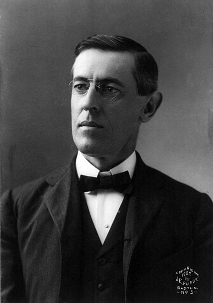
During his first administration, President Woodrow Wilson introduced segregation into several federal departments, for the first time since 1863. He supported some cabinet appointees in their request for segregation of employees and creation of separate lunchrooms and restrooms. He was highly criticized for this, especially as he had attracted numerous votes from blacks. The policy held for decades.[84]
One advantage of federal rule over the District of Columbia was that the public school teachers were considered federal workers. Although the schools were segregated, black and white teachers were paid on an equal scale. The system attracted highly qualified teachers, especially for the M Street School (later called Dunbar High School), the academic high school for African Americans.[85]

In July 1919, whites, including uniformed sailors and soldiers, attacked blacks in Washington during Red Summer, when violence broke out in cities across the country. The catalyst in Washington was the rumored arrest of a black man for rape; in four days of mob violence, white men randomly beat black people on the street, and pulled others off streetcars for attacks. When police refused to intervene, the black population fought back. Troops tried to restore order as the city closed saloons and theaters, but a summer rainstorm had a more dampening effect. A total of 15 people were killed: 10 whites, including two police officers; and five blacks. Fifty people were seriously wounded and another 100 less severely wounded.[86] The NAACP protested to President Wilson.[87]

In 1922, Washington was hit by its deadliest natural disaster when the Knickerbocker Storm dumped 18 inches (46 cm) of snow, causing the roof to collapse at the Knickerbocker Theater, a silent movie house. Ninety-eight people were killed, including a U.S. Congressman; 133 were injured.

On July 28, 1932, President Herbert Hoover ordered the United States Army to forcibly evict the "Bonus Army" of World War I veterans who gathered in Washington, D.C., to secure promised veterans' benefits early. U.S. troops dispersed the last of the "Bonus Army" the next day.

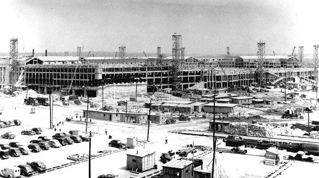
During the Great Depression of the 1930s, the city's population grew rapidly with the creation of additional Federal agencies under the New Deal programs of President Franklin D. Roosevelt, during which most of the Federal Triangle buildings were constructed. World War II brought further population increases and a significant housing shortage, as existing residents were urged to rent rooms to the influx of Federal staffers who arrived from throughout the country. During the war, as many as 200,000 railroad passengers passed through Union Station in a single day.[88] The Pentagon was built in nearby Arlington to efficiently consolidate Federal defense offices under one roof. One of the largest office buildings in the world, it was built rapidly during the early years of the war, partially opening in 1942, and complete in 1943.[89]
Civil rights

President Harry Truman integrated the Armed Forces and federal workplaces in 1948. Parks and recreation facilities in Washington, D.C. remained segregated until 1954, and public schools were desegregated soon after. When the city's Board of Education began building the John Phillip Sousa Junior High, a group of parents from the Anacostia neighborhood petitioned to have the school admit black and white students. When it was constructed, the Board declared that only whites could enroll. The parents sued in a case decided in the landmark Supreme Court ruling Bolling v. Sharpe. Partly due to the District's unique status under the Constitution, the court decided unanimously that all of D.C.'s public schools had to be integrated. In the wake of this and the landmark 1954 Supreme Court case Brown v. Board of Education, the Eisenhower administration decided to make D.C. schools the first to integrate, as an example to the rest of the nation.

In 1957, Washington became the first major city in the nation with a majority African-American population.[citation needed] Like cities in the North, it had received thousands of black people from the South in the Great Migration, starting during World War I and continuing until after World War II. With the buildup of government and defense industries during World War II, many new residents found jobs. In the postwar years, whites who were better established economically began to move to newer housing in adjoining states in the suburbanization movement that occurred around most major cities. They were aided by the extensive highway construction undertaken by federal and state governments.

On August 28, 1963, Washington took center stage in the American Civil Rights Movement, with the March on Washington and Dr. Martin Luther King, Jr.'s famed "I Have a Dream" speech at the Lincoln Memorial. Following the assassination of King on April 4, 1968, in Memphis, Washington was devastated by the riots that broke out in the U Street neighborhood and spread to other black areas, including Columbia Heights. The civil unrest drove many whites and middle-class blacks to move out of the city core. There had already been a steady movement of some residents to suburban locations in the search for newer housing and to avoid school integration. In the late 1960s and early 1970s, many businesses left the downtown and inner city areas, drawn to suburban malls and following residential development. Marks of riots scarred some neighborhoods into the late 1990s.

Electoral college votes
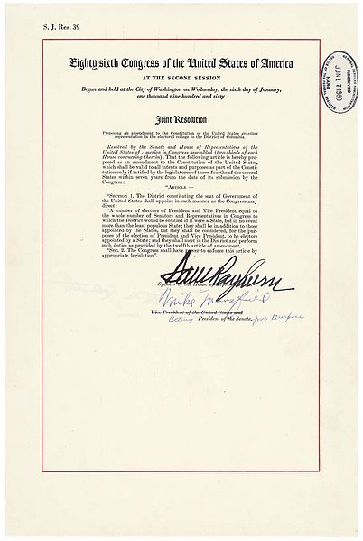
The Twenty-third Amendment to the United States Constitution, ratified on March 29, 1961, gave the people of Washington, D.C. the right to choose electors for president and vice president of the United States. The amendment states that the District shall be treated as though it were a state for all purposes relevant to the election of the president and vice president; and, specifically, that it shall have as many electors to which it would be entitled if it were a state, except that it cannot have more electors than the least populous state. However, the least number of electors any state can have is three, so the least number of representatives the District can have is three.

Home rule
In 1973, Congress passed the District of Columbia Home Rule Act, ceding some of its power over the city to a new, directly elected city council and mayor. Walter Washington became the first elected mayor of Washington, D.C.
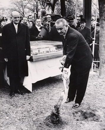
The first 4.6 miles (7.4 km) of the Washington Metro subway system opened on March 27, 1976, following years of acrimonious battles with Congress over funding and highway construction, including a rejected proposal to build a north-central freeway. The Washington Metropolitan Area Transit Authority had been created in 1973 through a merger of several local bus companies. Several new Metro stations such as Friendship Heights, Van Ness, Gallery Place, Columbia Heights, U Street, and Navy Yard – Ballpark eventually became catalysts for commercial development. The Kennedy Center opened, as well as several new museums and historic monuments on and around the National Mall.
In 1978, Congress sent the District of Columbia Voting Rights Amendment to the states for ratification. This amendment would have granted the District representation in the House, Senate, and Electoral College as if it were a state. The proposed amendment had a seven-year limit for ratification, and only sixteen states ratified it in this period.

The city's local government, particularly during the mayoralty of Marion Barry, was criticized for mismanagement and waste.[90] Barry defeated incumbent mayor Walter Washington in the 1978 Democratic Party primary. Barry was then elected mayor, serving three successive four-year terms. During his administration in 1989, The Washington Monthly magazine claimed that the District had "the worst city government in America".[91] After being imprisoned for six months on misdemeanor drug charges in 1990, Barry did not run for reelection.[92] In 1991, Sharon Pratt Kelly became the first black woman to lead a major U.S. city.[93]

Barry was elected again in 1994 and by the next year the city had become nearly insolvent.[92] In 1995, Congress created the District of Columbia Financial Control Board to oversee all municipal spending and rehabilitate the city government.[94] Mayor Anthony Williams won election in 1998. His administration oversaw a period of greater prosperity, urban renewal, and budget surpluses.[95] The District regained control over its finances in 2001 and the oversight board's operations were suspended in September of that year.[96]

Williams did not seek reelection in 2006. Councilmember Adrian Fenty defeated Council Chairwoman Linda Cropp in that year's Democratic primary race to succeed Williams as mayor and started his term in 2007. Shortly upon taking office, Fenty won approval from the city council to directly manage and overhaul the city's under-performing public school system.[97] However, Fenty lost a Democratic Party primary to former Council Chair Vincent Gray in August 2010. Mayor Gray won the general election and assumed office in January 2011 with a pledge to bring economic opportunities to more of the city's residents and under-served areas.[98]

21st century
Terrorism and security
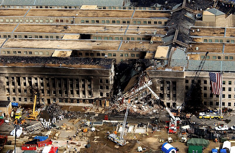
The Washington area was a main target of the September 11, 2001 attacks. One hijacked airplane was crashed into the Pentagon in Arlington County, Virginia, just across the Potomac River from Washington. The crash killed 64 aboard the plane and 125 people on the ground. Hijackers of United Airlines Flight 93, which went down in Pennsylvania, supposedly intended to target either the White House or the U.S. Capitol.Since September 11, 2001, a number of high-profile incidents and security scares have occurred in Washington. In October 2001, anthrax attacks, involving anthrax-contaminated mail sent to numerous members of Congress, infected 31 staff members, and killed two U.S. Postal Service employees who handled the contaminated mail at the Brentwood sorting facility.

During three weeks of October 2002, fear spread among residents of the Washington area, during the Beltway Sniper attacks. Ten apparently random victims were killed, with three others wounded, before John Allen Muhammad and Lee Boyd Malvo were arrested on October 24, 2002.

In 2003 and 2004, a serial arsonist set over 40 fires, mainly in the District and the close-in Maryland suburbs, with one fire killing an elderly woman. A local man was arrested in the serial arson case in April 2005 and pled guilty.

The toxin ricin was found in the mailroom of the White House in November 2003 and in the mailroom of U.S. Senate Majority Leader Bill Frist in February 2004.
After the September 11, 2001 attacks, security was increased in Washington. Screening devices for biological agents, metal detectors, and vehicle barriers became more commonplace at office buildings as well as government buildings. After the 2004 Madrid train bombings, local authorities decided to test explosives detectors on the vulnerable Washington Metro subway system.
When U.S. forces in Pakistan raided a house suspected of being a terrorist hideout, they found information several years old about planned attacks on Washington, D.C., New York City, and Newark, New Jersey. It was directed to intelligence officials. On August 1, 2004, the Secretary of Homeland Security put the city on Orange (High) Alert. A few days later, security checkpoints appeared in and around the Capitol Hill and Foggy Bottom neighborhoods, and fences were erected on monuments once freely accessible, such as the Capitol. Tours of the White House were limited to those arranged by members of Congress. Screening devices for biological agents, metal detectors, and vehicle barriers became more common at office buildings as well as government buildings and in transportation facilities. This ultra-tight security was referred to as "Fortress Washington"; many people objected to "walling off Washington" based on information several years old. The vehicle inspections set up around the U.S. Capitol were removed in November 2004.

Taken from and references on: http://en.wikipedia.org/wiki/History_of_Washington,_D.C. [09.09.2013]
No comments:
Post a Comment